2010

2007
GeoNames
The geonames.org geographical database is available for download free of charge under a creative commons attribution license. It contains over eight million geographical names and consists of 6.5 million unique features whereof 2.2 million populated places and 1.8 million alternate names. All features are categorized into one out of nine feature classes and further subcategorized into one out of 645 feature codes. (more statistics ...).
The data is accessible free of charge through a number of webservices and a daily database export. Geonames.org is already serving up to over 3 million web service requests per day.
Geonames is integrating geographical data such as names of places in various languages, elevation, population and others from various sources. All lat/long coordinates are in WGS84 (World Geodetic System 1984). Users may manually edit, correct and add new names using a user friendly wiki interface.
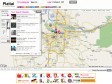
Platial.com
Platial enables anyone to find, create and use meaningful maps of Places that matter to them. We hope it can connect people, neighborhoods, cities and countries through a citizen-driven common context that goes beyond geopolitical boundaries. We are building it, because we adore Places.
mapufacture - helping to build the geospatial web
Mapufacture is a geo-aggregator. Find interesting feeds from blogs, photos, weather, friends, and activities. Build maps of the places you care about. Share these maps and use them on the go. Search for interesting around the world.

2006
Ordnance Survey mash-up takes on Google Maps - WebWatch - Breaking Business and Technology News at silicon.com
Le Géoportail devrait, lui aussi, accélérer la maneuvre !

1
(7 marks)
